GIS Services
At Steigerwaldt Land Services, our GIS team works tirelessly in their efforts to pursue the most efficient methods and tools to provide our clients with the highest quality map products and applications. Our team works in a collaborative effort with clients to ensure products and solutions meet expectations and the project goals. GIS solutions are developed to client-specific needs and provide meaningful and insightful analysis to answer difficult questions.
Imaging by David Wenzlik
Our team members are highly skilled and knowledgeable, specializing in the utilization of a range of software applications such as ArcMap, ArcGIS Pro, ArcGIS Online, field maps, and ArcGIS Survey123. We also have expertise utilizing various programming languages to create custom applications. The needs of our clients determine the software used, whether that may be map creation, data analysis, web applications, or data collection.
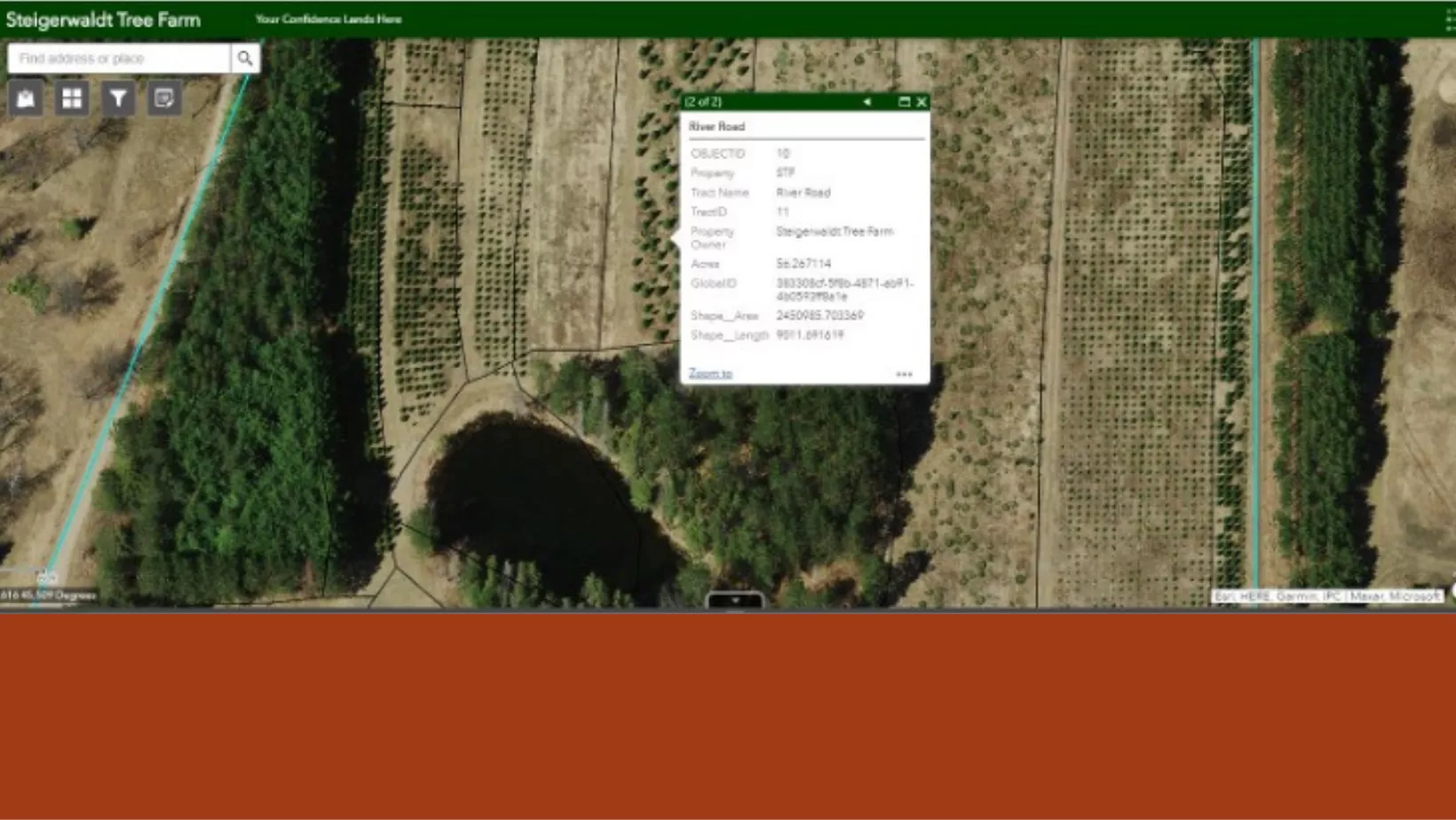
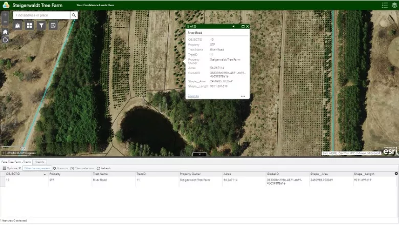
Many of our clients require fast and efficient access to spatial data which draws their interest to web applications. These applications allow for quick reference and management of project data and assist in project management. Web applications allow data to be accessed and used by specific individuals and teams in organizations and permit user access controls that relieve security and data integrity concerns.
GIS is an ever-growing component of natural resource businesses and organizations. Successful organizations strive continuously to adapt and keep pace with advancing technology increasing the demand for highly skilled GIS services. Steigerwaldt serves to meet and exceed the specific GIS and data objectives and requirements of all our clients. Contact us today to see how our team of experts can help with your GIS needs.
– Forrest Gibeault, Vice President of Analytics, Valuation, and Technology Solutions