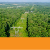
The Steigerwaldt team has added Unmanned Aircraft System (UAS) services, also known as drones, to our suite of tools available for land management, real estate, environmental, and surveying projects.
Innovative and effective mapping solutions have been one of the key cornerstones for services provided by Steigerwaldt since our business originated in 1957. The evolution of using drones to acquire high resolution, real-time aerial imagery and data fits precisely with our goal to employ the best technology available in order to meet our clients’ needs. Our applications include hardware and software solutions that provide the data needed for fast and reliable decisions.
What does this mean for you? We can provide highly specialized data and imagery suitable for a variety of applications including:
- Harvest boundary and cutting progress mapping
- Fast insect or disease mapping and monitoring
- Fire damage assessments
- Vegetation/competition and regeneration stocking assessments
- Visual imagery to enhance products or brochures
- Unauthorized land use or trespass
- 2D and 3D mapping and related applications
- Tree species precision mapping using spring and fall leaf-out and color
To discuss how this technology can be used to meet your land management or project objectives, please contact Tom Hittle.


